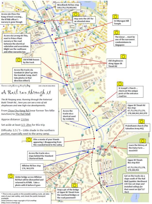
Walking route from Choa Chu Kang Road to Rail Mall
Here’s a map of A Rail Ran Through It – Walking route from Choa Chu Kang Road to Rail Mall, which includes good photo-taking spots. Thanks to the great effort from CY Leong!
Download high-res map of [download#10#size#nohits]
(Maps attributed to OneMap by SLA, http://www.onemap.sg/index.html)


The Girder bridge over Hillview road has been removed. You’ll need to walk / slide down the steep hill to get down, cross the road and climb up again.
No need to slide or climb. On the left, there is a slope which you can walk down but have do it slowly and carefully. To get back to the trail after crossing the road, walk towards the main road (Upper Bt Timah Road) and look for a small white building on the left. Turn in and you will find a pebbled path leading back to the trail.